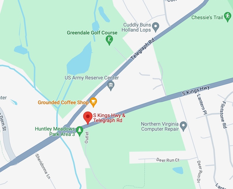
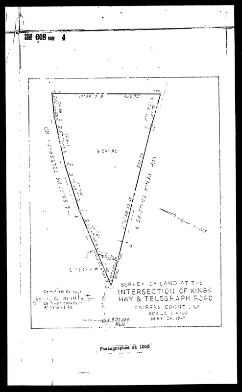
This Google Maps image is the exact location where the Louisa Ferguson property was located. This information was found via the 1948 Ferguson - Davis land deed, which features a diagram of the property and the intersection at which it was located (Telegraph Road and South Kings Highway). The land is now home to a US Army Reserve Center and coffee shop, among other things.
This is a page from the 1900 US Census (incl. William H. Carter denoted as Wm H Carter") with details pertaining to his person, birthplace, his occupation, and his current household members. Of note, not included is "Mary Carter".
This is a page from the 1870 US Federal Census (incl. "William H Carter") with details pertaining to his birthplace, home residence, parents, and if he attended school.
This page, showing a diagram of Louisa Ferguson's Telegraph Road property, is from the 1948 Ferguson - Davis land deed document. It shows measurements of the land and acreage.
This image displays an outline of Eliza A. Ford's property in 1980. The information for the land area was determined using the Tax Map Grid square 102-3 which was found in the Land Tax Records Book in 1960 and 1980 respectively.
This image displays an outline of Eliza A. Ford's property in 1960. The information for the land area was determined using the Tax Map Grid square 102-3 which was found in the Land Tax Records Book in 1960.
The deeds of John Brown’s land, which was sold in 1908. The names include William Dandridge Smith, Annie M. Smith, Mary E. Brooks, and John Brown himself.