This document is the federal census showing John Ford's family and various information on them. Tax records in 1900 show that John B. and Charlotte had about 10 kids together, yet according to the 1920 tax records, only three remained in the area.
Census data given by Ancestry, a document from 1920 has John B’s family listed, and during this time he was 72 years old. Census data obtained through Ancestry, a document from 1920 has John B’s family listed, and during this time he was 72 years old.
This deed involves John B. and Charlotte Ford. Charlotte Ford, in this case, refers to his wife. Although they do have a daughter named Charlotte; this is a legal document stating that the deed is between the couple. Although it is a little difficult to understand the cursive writing, it seems this document is passing on land/land rights from John B. to Charlotte.
This deed involves John B. and Charlotte Ford. Charlotte Ford, in this case, refers to his wife. Although they do have a daughter named Charlotte; this is a legal document stating that the deed is between the couple. Although it is a little difficult to understand the cursive writing, it seems this document is passing on land/land rights from John B. to Charlotte.
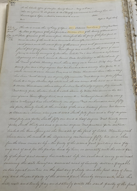
This document further confirms that the children of West Ford (William, Jane, Daniel and Julia) got an equal distribution of land in Gum Springs/Mount Vernon. Each receiving 52 ¾ acres of land, this is the earliest document that was retrieved from the Fairfax Archives. The land that was given to West Ford by George Washington’s cousin was substantial.
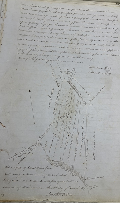
This document is the deed shared between the grantor, West Ford, and his son who is the grantee, William Ford. Created on the 17th of April 1857, this deed legally shows the official transfer of ownership. What’s unique about the deed itself is that it has a map representing where the land is being divided
This document is the deed shared between the grantor, West Ford, and his son who is the grantee, William Ford. Created on the 17th of April 1857, this deed legally shows the official transfer of ownership.
This item represents the lower portion of the map that outlines the ownership of the land in the Mount Vernon District. This map shows William Ford's land, his sibling's land, and how it is divided up amongst the children of these individuals.
This is proof that William H. Robinson also did business with Douglas S. Mackall who was a large landowner within the Northern Providence area. However, by this point, William H. Robinson had died and it was Sarah Robinson who now owned this land. However, the deed was done during his time of living on April 15th, 1907.
The picture details the deed book of George Carroll's purchase of 60 acres of land from Katie Johnston (the wife of Dennis Johnston) on November 18, 1899.
The text is zoomed in on a section of George Carroll's Will statement detailing his current wife to be Jane Carroll in December, 1917. He also mentions his two sons, Luther and William, who are step-sons of Jane.
The picture details the present day view, December 2023, of the Laurel Grove Baptist Church. The church burned down in December 2004 where it now is gated off.
The picture details artifacts of the founding members to honor their contribution to building the school. The museum also includes maps, books, and brochures which details further information about the school.
The picture details the outside of the Laurel Grove Colored School which is now a museum to honor those who have made huge contribution to its founding.
In 1884, the Laurel Grove Baptist Church was built by George Carroll, Middleton Braxton, and Thornton gray. the purpose was to build a sanctuary next to the Laurel Grove school for the kids and family to attend. The church burned on December 2004 with left are a tarp covering the remains to the basement.
The picture details the gravestone of George Carroll who was born on February 22, 1856 and died on December 17, 1917. He was also the husband of Jane (Jannie) Carroll.
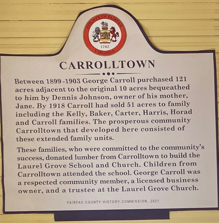
The land marker details Carrolltown as a small community spanning over 121 acres which George Carroll had purchased in the span of his life time. The sign also states that George made huge contribution to the developments of Laurel Grove School and Church by donating lumbar.