Ford Land and Maps
Molly Pitts
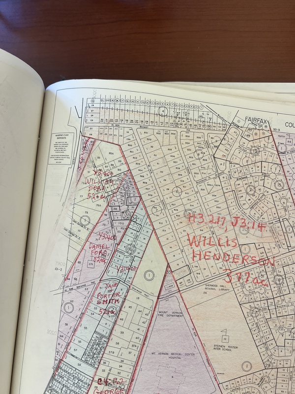

These images are the map showing the land that belonged to the children of West Ford. The original 211 acres are outlined on the map, and clearly show the lines dividing the land amongst the children. William Ford, John Ford’s father, then divided up his land (in the yellow) amongst his children. Seeing as the Ford family was a relatively large family that can be traced back to George Washington, this information is incredibly helpful in providing a visual aid to conceptualize how much land William Ford had. On the right-hand side of William’s land, there was the land of Daniel Ford and Jane Ford.
The authors continued in one of the chapters about influential blacks from 1840-1870; one of the men being West Ford. West Ford is John’s grandfather, and he was the one who owned William Ford’s land first. West Ford had owned land in Fairfax before the Civil War. Harper Magazine was determined to write an article about Mount Vernon in 1859, this resulted in the reported speaking with West Ford quite a bit, who was 71 at the time. In childhood he was one of George Washington’s slaves. During this time, many blacks had befriended whites who could help them acquire more wealth and landownership. There were a large percentage of previous slaves who were able to use those relationships, and other means, to improve their economic status and obtain land within the 1840’s and 1850’s. West Ford was one of those individuals; he owned land in Gum Springs. This article is considered a blue moon; it wasn’t often that black people were the center focus of an article, unless it was outlining the horrific acts committed against them. In Demonic Ground, McKittrick says, “I have turned to geography and black geographic subjects not to provide a corrective story... Rather, I want to suggest that space and place give black lives meaning in a world that has, for the most part, incorrectly deemed black populations and their attendant geographies as ‘ungeographic’ and/or philosophically undeveloped.”
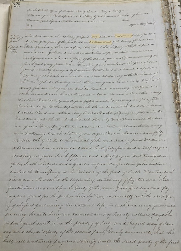
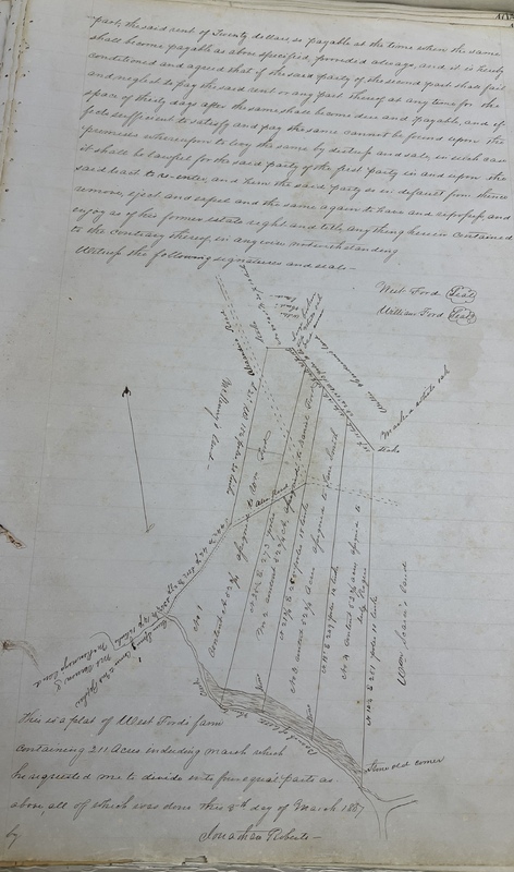
The reason for me including this specific document within the map section is because it has a unique quality in the deed itself; it obtains a map representing where the land is being divided. This document is the deed shared between the grantor, West Ford, and his son who is the grantee, William Ford. Created on the 17th of April 1857, this deed legally shows the official transfer of ownership. Other documentation was recovered showing the transfer of land to William’s other siblings, however, William was one of children who stayed in Gum Springs the entirety of his life which means there will be more records of his life.