-
Title
-
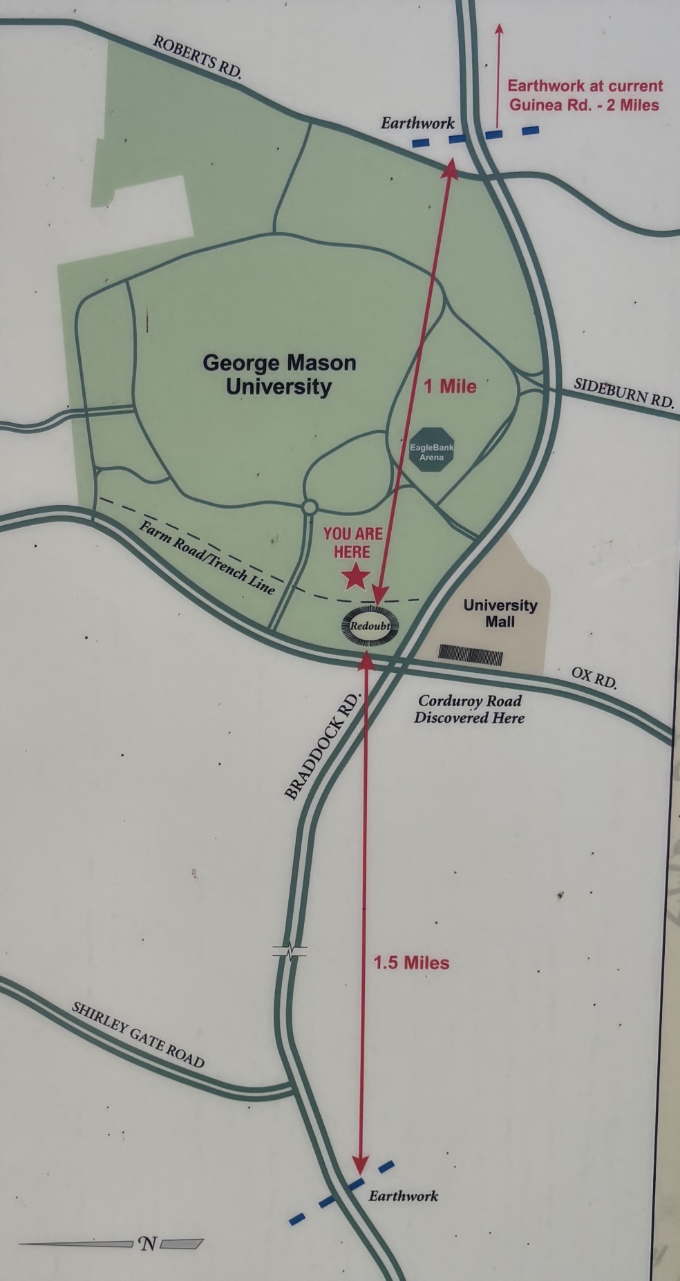
Map from Interpretive Sign at Farr's Redoubt
-
Description
-
Image of a map from an interpretive sign at Farr's Redoubt located at the entrance of the trail. The map specifies the location of the redoubt, trench line, and documented earthworks constructed nearby.
-
Creator
-
Bull Run Civil War Round Table, George Mason University History and Facilities Departments
-
Type
-
Map
-
Source
-
Interpretive marker at Farr's Redoubt Historic Site
-
Bibliographic Citation
-
George Mason University and Bull Run Civil War Round Table. Farr’s Cross Roads. George Mason University History Trail, Fairfax, VA. Outdoor interpretive marker, viewed Aug 21, 2026.
-
Contributor
-
Lucas Gimm