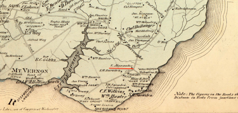
Zoomed in view of Sandy Alexander House in 1878 Mount Vernon District Map Hopkins Atlas
Item
-
Title
-
Zoomed in view of Sandy Alexander House in 1878 Mount Vernon District Map Hopkins Atlas
-
Description
-
This image is created by the author from the 1878 map of the Mount Vernon district is in the Hopkins real estate atlas. It shows a zoomed in version of the map that pinpoints the home of Sandy Alexander which is underlined here by the contributor.
-
Bibliographic Citation
-
Griffith Morgan Hopkins, Atlas of Fifteen Miles around Washington, Including the County of Prince George, Maryland (Philadelphia: G.M. Hopkins, 1878). Also available https://www.fairfaxcounty.gov/maps/static-map-gallery
-
Date
-
1878