Andrew Jackson Mount Vernon Historic Map
Item
-
Title
-
Andrew Jackson Mount Vernon Historic Map
-
Description
-
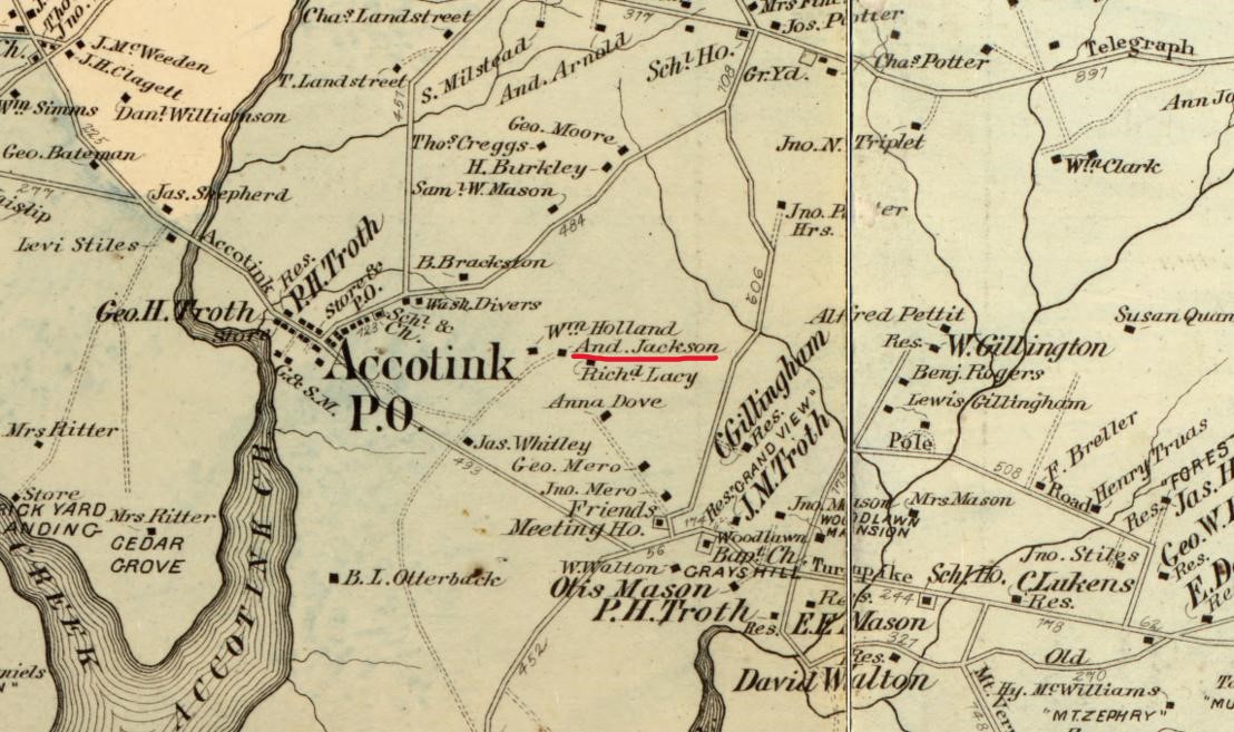
This historical map of the Mount Vernon District places the Jackson Property between Accotink and Dogue Creek and next to the Accotink Post Office in 1879
-
Bibliographic Citation
-
Hopkins, Griffith Morgan, Jr. Andrew Jackson Mount Vernon Historic Map, "Atlas of fifteen miles around Washington, including the county of Montgomery, Maryland", Fairfax County Courthouse. Fairfax, Virginia, 1879. https://www.loc.gov/resource/g3850m.gct00186/?sp=46&r=0.212,0.291,0.472,0.219,0
-
Contributor
-
Hughston, Caleb
-
Source
-
Historic Records Center, Fairfax County Circuit Court
-
Spatial Coverage
-
District of Mount Vernon