Around 1880s, Overall Northern VA Map
Item
-
Title
-
Around 1880s, Overall Northern VA Map
-
Description
-
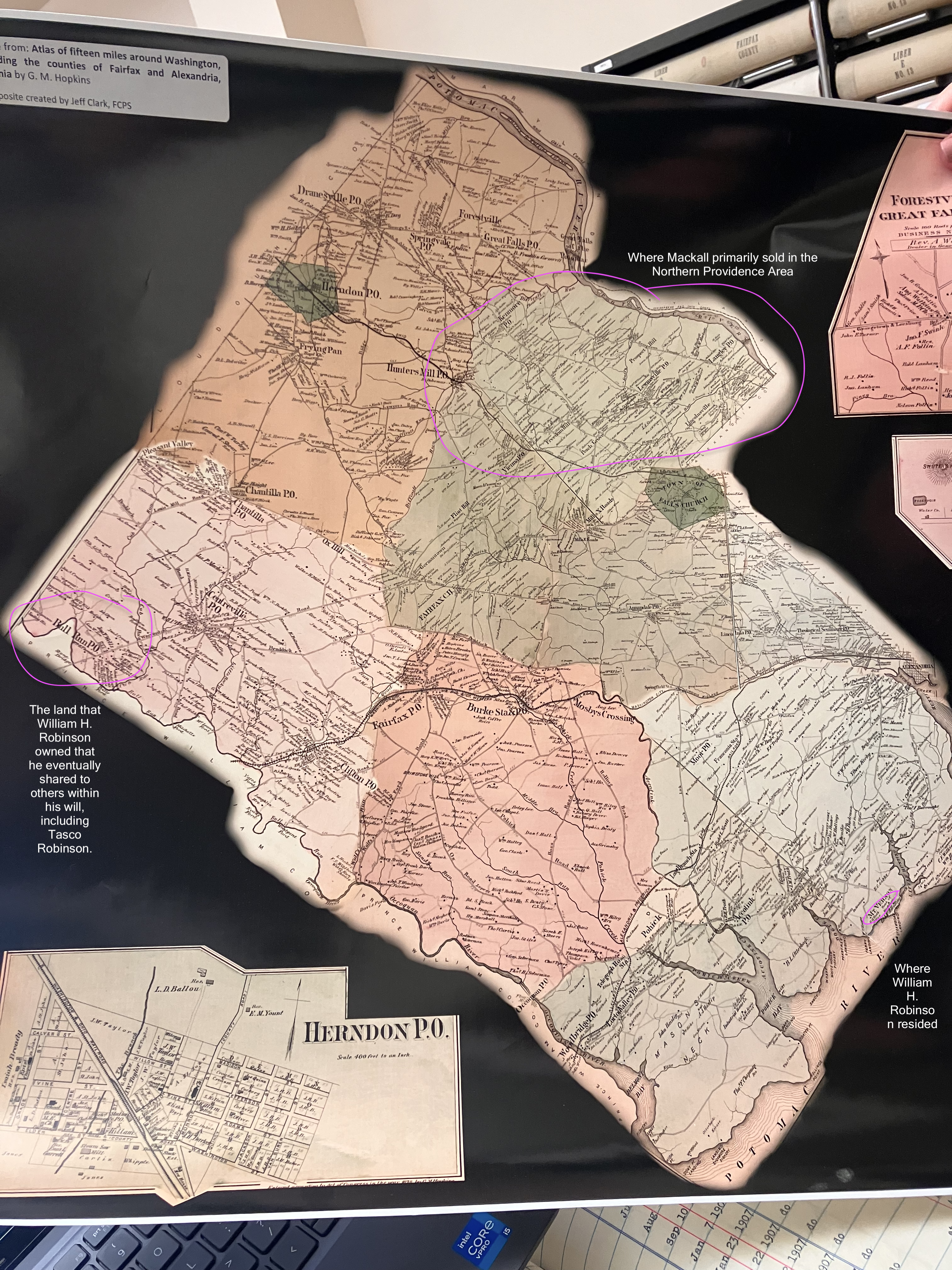
This overall map of Northern Virginia shows the three spots where William H. Robinson 1) resided 2) had his hand in Bull Run Rd. 3) had a connection with Mackall where he also had land in. This is important because this shows that William H. Robinson didn't just stay in Mt. Vernon all his life.
-
Last name, first name (Mason, George)
-
Hopkins, G.M.
-
Source
-
Atlas of fifteen miles around Washington, including the counties of Fairfax and Alexandria, Virginia
-
Enter an appropriate Chicago Style citation for the original item.
-
Hopkins, G.M. Atlas of fifteen miles around Washington, including the counties of Fairfax and Alexandria, Virginia. Fairfax County Circuit Court Historic Records Center, Fairfax, Virginia.
-
Enter your name. Last name, first name
-
Nguyen, Jessica
 Overall Northern VA Map