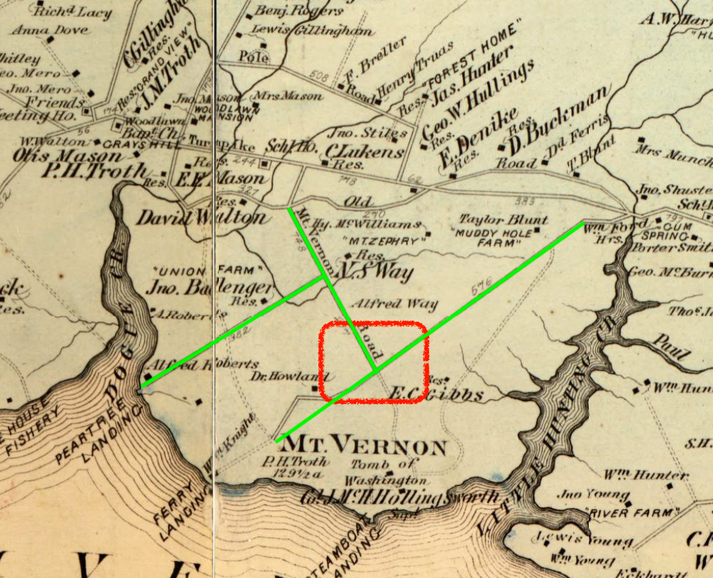
1879 Map of Mount Vernon
Item
- Title
- 1879 Map of Mount Vernon
- Description
- Atlas of 15 miles around Washington, including the county of Montgomery, Maryland. The squared off section includes the supposed location of Lloyd Washington's estate in the 1870s and 80s.
- Date
- 1879
- Source
- Library of Congress
- Bibliographic Citation
- 1879 Map of Mount Vernon, https://www.loc.gov/resource/g3850m.gct00186/?sp=46&r=-0.076,-0.008,1.137,0.714,0, Library of Congress, Fairfax, Viginia
- Contributor
- Marchetti, Ava
- Item sets
- Black Lives Next Door in Fairfax
- Media
 Map of Mount Vernon