1878 Atlas of 15 Miles around Washington D.C.
Item
-
Title
-
1878 Atlas of 15 Miles around Washington D.C.
-
Description
-
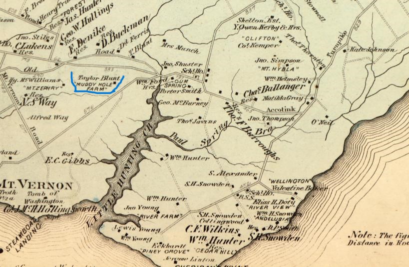
This image from the G. M. Hopkins 1878 Atlas of fifteen miles around Washington, includes Mount Vernon and Taylor Blunts property near Muddy Hole Farm which was sold to him by Lovelace Brown
-
Bibliographic Citation
-
Hopkins, Griffith Morgan, Jr. Atlas of fifteen miles around Washington, including the county of Montgomery, Maryland. Philadelphia: G.M. Hopkins, 1879, 1879. Map. https://www.loc.gov/item/87675339/.
-
Creator
-
Charles Morin
-
Date Created
-
12/1/2023
 Intro Map.jpg