Mary E Brooks Property Map
Item
- Title
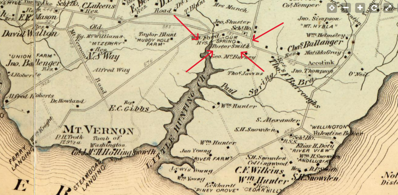
- Mary E Brooks Property Map
- Description
- This image from the G. M. Hopkins 1878 Atlas of fifteen miles around Washington, including the county of Montgomery, Maryland shows Porter Smiths property.
- Source
- Mt. Vernon Dist. No. 3 | Library of Congress. (n.d.). Retrieved November 12, 2023, from https://www.loc.gov/resource/g3850m.gct00186/?sp=46&r=0.078,0.344,1.218,0.595,0
- Enter your name. Last name, first name
- McNally, Keira
- Item sets
- Black Lives Next Door in Fairfax
- Site pages
- Mary E Brooks' Land
- Media
 Mary E Brooks Land Map