Louisa Ferguson Property -- Exact Location
Item
-
Title
-
Louisa Ferguson Property -- Exact Location
-
Description
-
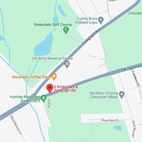
This Google Maps image is the exact location where the Louisa Ferguson property was located. This information was found via the 1948 Ferguson - Davis land deed, which features a diagram of the property and the intersection at which it was located (Telegraph Road and South Kings Highway). The land is now home to a US Army Reserve Center and coffee shop, among other things.
-
Bibliographic Citation
-
Google Maps. (n.d.). [Google Maps pin on land at the intersection of Telegraph Road and South Kings Highway, VA]. 4 Dec. 2023, https://www.google.com/maps/place/S+Kings+Hwy+%26+Telegraph+Rd,+Rose+Hill,+VA+22310/@38.7688153,-77.1218328,17z/data=!4m10!1m2!2m1!1stelegraph+road+and+kings+highway!3m6!1s0x89b7adf41471d5cf:0x5bbc6afb7730159a!8m2!3d38.7676443!4d-77.1209745!15sCiB0ZWxlZ3JhcGggcm9hZCBhbmQga2luZ3MgaGlnaHdheZIBDGludGVyc2VjdGlvbuABAA!16s%2Fg%2F11k4p4_vrd?entry=ttu
-
Contributor
-
Alyssa Turner
-
Date
-
December 4th, 2023
-
Source
-
Google Maps