Louisa Ferguson
Louisa (erroneously written as “Louise” or even “Laura” in records) Ferguson was an African American woman living in the Mount Vernon district of Fairfax County in the 1800’s. Louisa lived from roughly 1810-1885 according to information recorded in the census. Louisa, and later her children, owned approximately 5-acre lot of property on Telegraph Road.

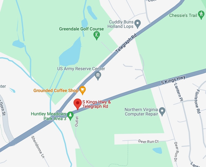
Louisa Ferguson Property -- Exact Location
Google Maps image of the Telegraph Road and South Kings Highway intersection in the Mount Vernon District, VA where Louisa's property was located.
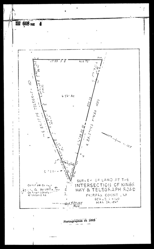
Through my research, I found that the property belonging to Louisa Ferguson had been in her family long before she had it; in total, they had the property from the 1820s to the 1940s, and perhaps longer. The early roots of this Telegraph Road property had little information, because of few records available going back to the 1820s. A land deed from 1948 shows an aerial diagram of the property, which was about 4.25 acres at the time. The diagram specifies the intersection that the property sat at, which was Telegraph Road and South Kings Highway. The triangle-shaped property, which still exists today, is now home to a US Army Reserve Center and a coffee shop, among other things.
The significance of this exhibit and the Louisa Ferguson property is that it tells us a lot about life as a free black American or former slave in an 1800s Southern state. Census information provides direct evidence about the lives of these people, and we can infer other information through exploration of historic records. Many black Americans in this era of oppression did not have their records kept, and for those who did, they were often poorly maintained. Their descendants today may still suffer from a lack of knowledge because of this. Having access to and an understanding of this history is necessary to preserve their stories and continue learning from the past.
Fairfax Circuit Court Historic Records Center
Google Maps. (n.d.). [Google Maps pin of Telegraph Road, VA]. 4 Dec. 2023, https://www.google.com/maps/place/Telegraph+Rd,+Virginia/@38.7820094,-77.2840967,11z/data=!4m6!3m5!1s0x89b7ad913285d34d:0xa5b01f235e4b2a2a!8m2!3d38.7589894!4d-77.1350946!16s%2Fg%2F1vs5xm27?entry=ttu
Google Maps. (n.d.). [Google Maps pin on land at the intersection of Telegraph Road and South Kings Highway, VA]. 4 Dec. 2023, https://www.google.com/maps/place/S+Kings+Hwy+%26+Telegraph+Rd,+Rose+Hill,+VA+22310/@38.7688153,-77.1218328,17z/data=!4m10!1m2!2m1!1stelegraph+road+and+kings+highway!3m6!1s0x89b7adf41471d5cf:0x5bbc6afb7730159a!8m2!3d38.7676443!4d-77.1209745!15sCiB0ZWxlZ3JhcGggcm9hZCBhbmQga2luZ3MgaGlnaHdheZIBDGludGVyc2VjdGlvbuABAA!16s%2Fg%2F11k4p4_vrd?entry=ttu
By: Alyssa Turner