Race Barriers
This section of Black Land Matters aims to focus on the physical obstacles, as well as codified restrictions, that limited the expansion and mobility of Black individuals and communities.
- Subject of Research
- Halls Hill Segregation Wall; 1930s
- Story
-
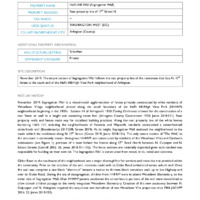
Segregation Wall is a mixed-match agglomeration of fences privately constructed by white residents of Woodlawn Village neighborhood platted along the south boundary of the Halls Hill/High View Park (HHHVP) neighborhood beginning in the 1930s. Section 14 of Arlington’s 1930 Zoning Ordinance allowed for the construction of a rear fence or wall to a height not exceeding seven feet (Arlington County Government 1930; Jones 2018:151). Rear property walls and fences made way for racialized building practices. Along the rear property line of the white homes bordering Halls Hill, including the neighborhoods of Fostoria and Waycroft, residents constructed a seven-foot-tall cinderblock wall (Bestebreurtje 2017:208; Green 2019). At its height, Segregation Wall enclosed the neighborhood to the south behind the residences along N. 17th Street (Green 2019; Jones 2018:151). The only extant section of “The Wall,” as the structure is commonly known throughout HHHVP, was constructed by residents of the Woodlawn Villas and Cardwells subdivisions (see Figure 1); portions of it exist behind the homes along 17th Road North between N. Culpeper and N. Edison Streets (Carroll 2002: 26; Jones 2018:151-152). The fence sections are materially disjointed given each resident was responsible for building on their own lot. The Segregation Wall is constructed from wood, brick, metal and concrete.
Glebe Road to the southwest of the neighborhood was a major thoroughfare for services and amenities not provided within the community. Prior to the erection of the wall, residents could walk to Glebe Road unhindered across unbuilt land. Once the wall was complete a one block “short-cut” became a twelve to thirteen block circuitous walk up to Lee Highway and over to Glebe Road. During the era of desegregation, children from HHHVP were to attend Woodlawn Elementary, on the other side of Segregation Wall. After HHHVP parents petitioned the school board, portions of the wall were demolished to allow school children passage to the newly integrated Woodlawn Elementary. Creation of this new accessway between N. Culpepper and N. Abingdon required the acquisition and demolition of two Woodlawn Villa properties circa 1966 (ACHPP 2016: 22; Jones 2018:152).
In February 2017, Arlington County unveiled the historic marker which reads:
This wall is a reminder of racial segregation in the historically African American community of Halls Hill. During construction of the Woodlawn Village subdivision in the 1930s, a wall of various materials and heights was built here to separate blacks from the adjacent white neighborhood. The only through-street in Halls Hill at that time was N. Edison St. During the late 1950s, children from Hall’s Hill removed a small section of the wall to create a passage to a nearby creek. In 1966, Arlington County removed a larger section of the wall, allowing full access to and from Halls Hill. Sections of the wall still stand today.
Erected in 2016 by Arlington County, Virginia in honor of the 150th Anniversary of Hall’s Hill.
The marker was a collaborative effort between the HHHVP Historic Preservation Coalition and the County’s Historic Preservation Program to celebrate the 150th anniversary of the neighborhood. The remnants of Segregation Wall are a sobering reminder of the most literal interpretation and representation of the nation’s segregation era. However, “the wall ha(s) become more of an education tool than a racist barrier…a way to teach people about what Jim Crow racism looked like and felt like” according to sentiments of the now more racially diverse HHHVP and surrounding areas (Prior 2019). - Place
- Halls Hill Highview Park
- Item sets
- Black Mobility Archive: Arlington, VA

- Subject of Research
- Green Valley (formerly Nauck) Segregation Wall
- Story
-
In the late 1950’s, a wooden fence was the “de facto” segregation wall between the white enclave of Arlington Courts apartments and parcels adjacent to it and Green Valley (formerly Nauck) a historic Black neighborhood.
- Item sets
- Black Mobility Archive: Arlington, VA


- Subject of Research
- 1921 Restrictive Covenant in Arlington Neighborhoods
- Story
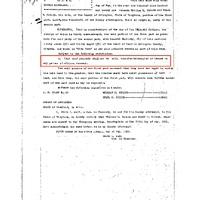
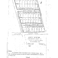
- Use of restrictive covenants proliferated Arlington’s neighborhoods. These covenants prohibited home sales to African American or Black Arlingtonians based on race and/or religion. For example, this deed dated May 5, 1921 for a tract of land known as "City View" stated, “1. That said property shall not be sold, transferred occupied or leased to any person of African descent."
- Place
-
City View
Boulevard Manor
Virginia Heights
- Item sets
- Black Mobility Archive: Arlington, VA
- Subject of Research
- 1937 Restrictive Covenants in Arlington Neighborhoods
- Story
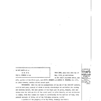
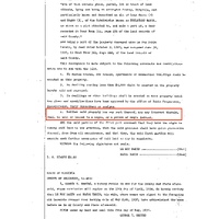
- Use of restrictive covenants proliferated Arlington’s neighborhoods. These covenants prohibited home sales to African American or Black Arlingtonians based on race and/or religion. For example, this deed dated May 21, 1937 for a Subdivision known as "Boulevard Manor" stated, “4. Neither said property nor any part thereof, nor any interest therein, shall be sold or leased to a negro, or a person of negro descent."
- Place
-
City View
Boulevard Manor
Virginia Heights
- Item sets
- Black Mobility Archive: Arlington, VA
- Subject of Research
- 1947 Restrictive Covenants in Arlington Neighborhoods
- Story
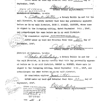
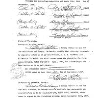
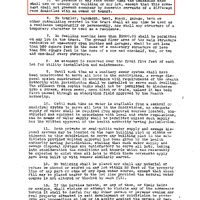
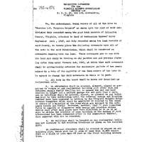
- Use of restrictive covenants proliferated Arlington’s neighborhoods. These covenants prohibited home sales to African American or Black Arlingtonians based on race and/or religion. For example, this deed dated September 24, 1947 for lots known as "Virginia Heights" stated, “5. No persons of any race other than the Caucasian Race shall use or occupy any building or any lot, except that this covenant shall not prevent occupancy by domestic servants of a different race domiciled with an owner or tenant."
- Place
-
City View
Boulevard Manor
Virginia Heights
- Item sets
- Black Mobility Archive: Arlington, VA
- Subject of Research
-
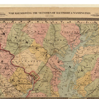
1861 War map, showing the vicinities of Baltimore & Washington
- Item sets
- Black Mobility Archive: Arlington, VA
- Media
 war map.png
No item selected