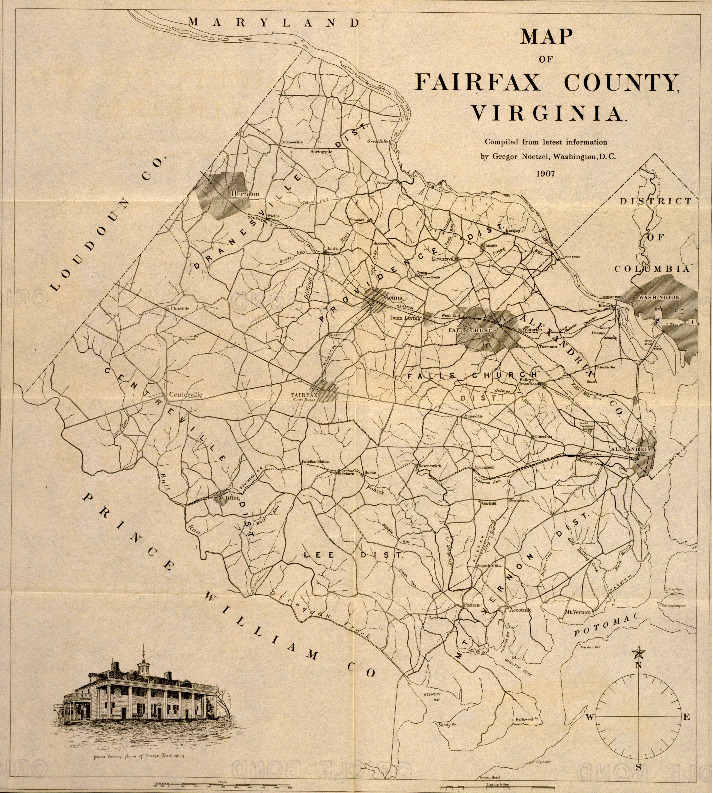
1907 Fairfax County Map
Item
-
Title
-
1907 Fairfax County Map
-
Repository
-
Fairfax County Static Map Gallery
Link: https://fairfaxcountygis.maps.arcgis.com/sharing/rest/content/items/1d4fd93de0b84153854488a58e8fb786/data
-
Date Created
-
1907
-
Creator
-
Gregor Noetzel
-
Recipient
-
Government of Fairfax County, Virginia
-
Description
-
The Noetzel map of Fairfax County with major roads, streams, and annotated supervisor districts. Created in 1907 by Gregor Noetzel.
-
Research Themes
-
Fairfax County Map
Northern Virginia Map
Early 20th Century
Early 20th Century Northern Virginia
-
Type
-
Map
-
Researcher Name
-
Jacob Connelly
-
Relation
-
Primary Source
-
Date
-
Early 20th Century
-
Spatial Coverage
-
Fairfax County
-
Bibliographic Citation
-
Noetzel, Gregor. “1907 Fairfax County Map.” Washington, D.C., United States: Government of Fairfax County, Virginia, 1907. Fairfax County Static Map Gallery. https://fairfaxcountygis.maps.arcgis.com/sharing/rest/content/items/1d4fd93de0b84153854488a58e8fb786/data.