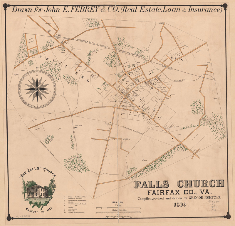
Falls Church, Fairfax Co., Va.
Item
-
Title
-
Falls Church, Fairfax Co., Va.
-
Repository
-
Library of Congress - Geography and Map Division
-
Date Created
-
1890
-
Creator
-
Gregory Noetzel
Published by: Bell Bros., Photo-Lithographers
-
Recipient
-
"Drawn for John E. Febrey & Co. (Real Estate, Loan & Insurance)"
-
Description
-
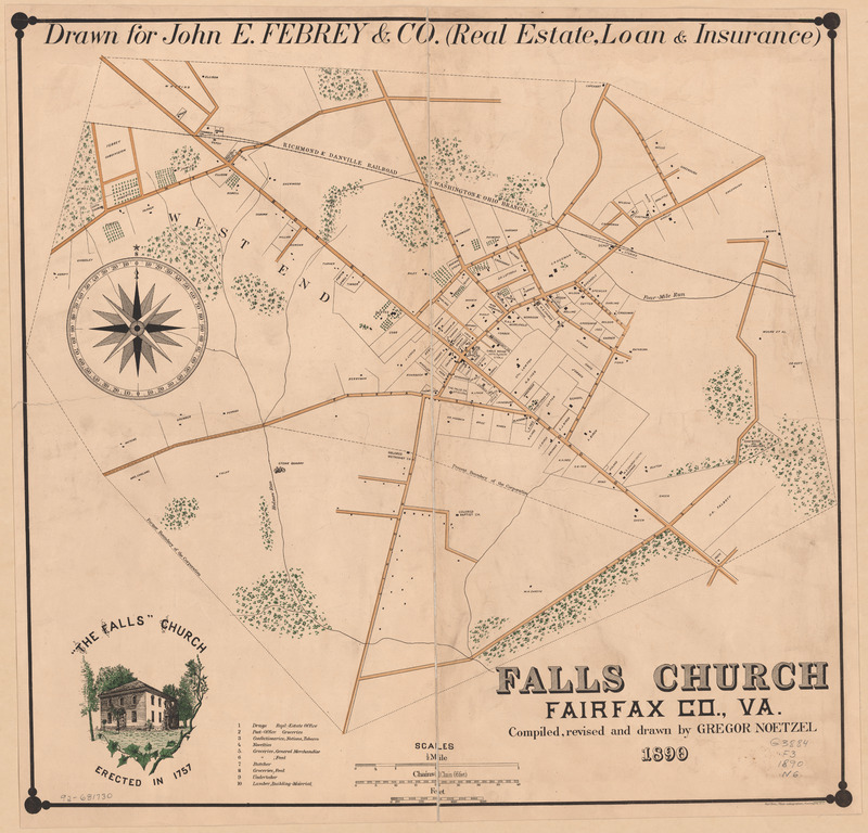
Map drawn by Gregor Noetzel in 1890 for the town of Falls Church. The map includes the retroceded territory in South Falls Church demarcated by a dashed line under the title "Present Boundary of the Corporation." This land that was retroceded in 1887, and voted to return to the County in 1890 contained a large contingent of Black homes, and dropped the voter rolls of the Black community in Falls Church by half. The line splits the land of Tinner Hill in half (the land is bordered by Lincoln St. to the East, Fairfax St. to the North, and the boundary line in its midpoint).
This act to cede land to the county was not slow violence in the way this research describes the concept. However, the action was a direct effort to gerrymander the community, and it removed Black members of the community. It established future actions of slow violence, and enabled displacement in place for these communities in the ceded lands and Tinner Hill as they lost their voice for power in Falls Church.
-
Research Themes
-
Map
Falls Church
Gerrymandering
Displacement in Place
Ceded Lands
Segregation
Slow violence
-
Type
-
Map
-
Researcher Name
-
Jacob Connelly
-
Bibliographic Citation
-
Noetzel, Gregor. “Falls Church, Fairfax Co., Va.” Image. Washington, D.C: Bell Bros., Photo-Lithographers, 1890. Geography and Map Division. Library of Congress. https://www.loc.gov/resource/g3884f.la002358/.


