Loudoun County Zoning Districts Map
Item
-
Title
-
Loudoun County Zoning Districts Map
-
Repository
-
Loudoun County Department of Planning and Zoning
-
Date Created
-
2023
-
Creator
-
Loudoun County
-
Description
-
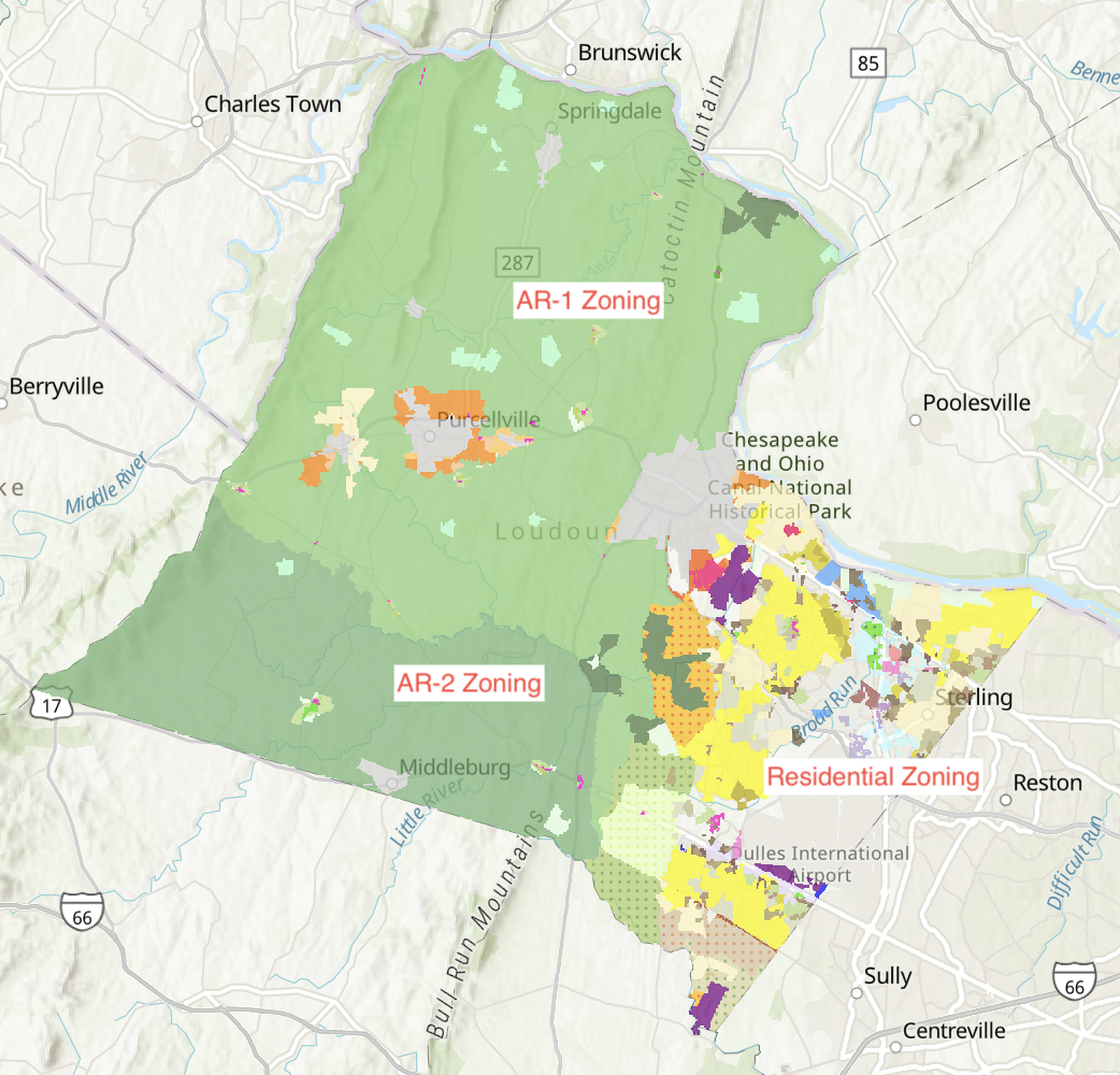
Map of the zoning districts in Loudoun County. The eastern third is a mixture of residential zoning that allows for development at denser levels. On the other hand the western two-thirds of the County are zoned for Agricultural Rural 1 and Agricultural Rural 2, save for larger communities in the area, such as Purcellville, and St. Louis with different zoning laws. AR-1 and AR-2 are used in efforts to stifle development in dense settings controlling for acreage at larger rates from 1 dwelling per 10 acres up to 1 dwelling per 50 acres. This zoning is part of the larger project of controlled modernity in Loudoun County.
-
Index/Partial Transcript
-
https://experience.arcgis.com/experience/6cc9a0c4f06f4c23952364da63f779fc/
-
Research Themes
-
St. Louis
Loudoun County
Zoning Map
Controlled Modernity
Myth of Progress
-
Type
-
Map